|
Around Cape Scott - June 2005 |

|
|
By Jamie Orr - Victoria, British Columbia - Canada |
This summer, I had the opportunity to sail around around Cape Scott, at the northern tip of Vancouver Island, and explore Quatsino Sound, one of the big sounds on the west coast. Chris Bennett was spending three months in sailing around the island, exploring the various bays and inlets as he went. His wife Sharon joined him for a couple of weeks near the beginning, but for most of the trip, Chris sailed alone or relied on friends to crew for a week or so at a time. This provided those of us less fortunate beings with some great sailing.
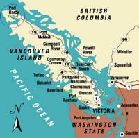 |
Vancouver Island, showing the area of our cruise.
(click images for larger views) |
|
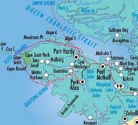
| Here’s a close-up of northern Vancouver Island with our track marked in red. Not much of a chart, but it more or less shows where we went. |
|
|
Meanwhile, Sharon waited and mowed the lawn. I think she deserves a large slice of recognition for not getting fed-up and changing the locks while Chris was off chasing his dream!
Fraser Howell, from Halifax, was the other crew member during my week aboard. Although we live at opposite ends of the country, Fraser and I had met before through Chebacco News, (now seen at www.chebacco.com) as both of us sail our own Bolger Chebaccos. Shortly before Fraser and I were to join the boat, Chris told us he had to go back to Victoria for a few days and would be leaving the boat on the day we joined it. However, he generously insisted that Fraser and I carry on around the cape and he would meet us somewhere on the other side when his business in Victoria was done.
So on Saturday, Fraser and I drove six and a half hours north from Victoria to Port Hardy, at the far end of Vancouver Island. When we arrived, Chris and Danny, who crewed during the previous week, were working on the engine and had odd bits strewn all around the cockpit. With some relief, we learned that it wasn’t a serious problem, but the engine had been running a little hot at higher speeds. It has raw water cooling (i.e. sea water) and this can cause corrosion over time, which can constrict the cooling passages. A good flushing with muriatic acid appeared to fix the problem.
The boat, Optima, is a Cal 2-29, the cruising version of the Cal 29. I’d been out in her a few times with Chris, so I was somewhat familiar with her. She has a good size keel, not a full keel but not an extreme fin either, and a spade rudder. She balances well and will sail nicely under either main or genoa. Down below, she has spacious accommodation with a head, galley and lots of storage space. And best of all, there is adequate headroom for a six-footer!
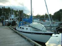 |
Optima in Port Hardy, northern Vancouver Island.
(click images for larger views) |
|
As mentioned, Chris had to go south for a few days. We arranged to rendezvous at Coal Harbour, at the eastern end of Quatsino Sound, the most northerly of the five big sounds on Vancouver Island’s west coast. It cuts almost right through the top end of the island and as Coal Harbour is at the eastern end, it’s only 10 miles by road from Port Hardy. We agreed to meet there on Wednesday afternoon, four days hence. Chris and Danny then climbed into my van and headed south.
Fraser and I stowed our gear then set about changing the headsail for a smaller one, in anticipation of the stronger winds expected at Cape Scott and on the west coast generally. The smallest jib aboard was a 120% genoa, which could be made still smaller with the roller furling/reefing gear. Neither Fraser nor I had had a lot of (or any?) experience with roller furling units, but by the time we finished the sail change, including rewinding the furling line that somehow escaped, we knew this one pretty well!
We spoke to the crew of another boat, also headed around Vancouver Island. Sans Souci is maybe 34 feet long and even more luxurious below than Optima. The owners were on their second trip around, so were able to pass on some first hand knowledge.
Together we reviewed the chart. To reach Cape Scott from Port Hardy, one sails up Goletas Channel between Vancouver Island and a number of smaller islands for about 22 miles. Most boats stop at Bull Harbour on the most westerly island, Hope Island, for the night. The time of departure from Bull Harbour is usually chosen so as to pass the Nahwitti Bar, half an hour from the harbour, at high water slack, when there is no current either way, and the ebb tide will soon be running towards Cape Scott.
Nahwitti Bar is the biggest obstacle encountered in getting to the cape. It stretches all the way from Vancouver Island to Hope Island, and the big ocean swells coming in from the Pacific pile up as they reach the shoal water. It’s particularly bad when the wind is blowing against the tide as the current can reach five knots and overfalls are not uncommon. The folks on Sans Souci recommended avoiding the bar altogether by going behind the Tatnall Reefs, on the Vancouver Island side. These reefs, although not visible on the surface, provide shelter from the big waves, and once you come out on the other side of them, you’re past the bar. It’s not as difficult as it sounds to avoid the reefs, as the kelp beds highlight the shallows.
The weather forecast for the following day was a good news/bad news affair. The bad news was a storm warning, the good news was that the storm-force winds weren’t expected until after noon, and the winds would be coming from the southeast, at our backs, when they came. We thought we could reach Bull Harbour well ahead of these, and if they arrived early, at least they’d be blowing in the right direction. Once in Bull Harbour we would be well protected, and could sit tight until conditions improved enough to go on.
At 7:00 am on Sunday we motored out of Hardy Bay into Goletas Channel. Sans Souci left the dock about the same time, but was motoring a little faster and pulled ahead. Once out of the bay, we found a light wind from the northeast, so we shut down the motor (it had shown no signs of its previous overheating problems, for which we were glad) and started sailing. We had a pleasant sail for twenty miles or so, mentally ticking off the islands as we passed them. The strong winds didn’t materialize as forecast, in fact the wind dropped until we were forced to restart the motor half a mile from the entrance to Bull Harbour.
| caption |
|
|
The formerly public dock there is now owned and operated by the Tlatlasikwala First Nation. We were charged for moorage at the same rate we paid in Port Hardy, but there was an additional charge if we wanted to go ashore as the whole island, being an indian reserve, is private. We paid the fee, then hiked to the head of the harbour and across a narrow neck of land to Roller Bay on the north side of the island to the beach. This was all smooth round stones, piled up by the waves at a steep angle, and was fairly hard walking. The ocean was relatively quiet that day, with none of the big rollers that give the bay its name.
Back at the dock, we said hello to the folks on Sans Souci, who were listening to the weather forecast and entering waypoints into their GPS, in preparation for the journey to Quatsino Sound. We also tuned in the forecast, to hear that strong south-easterly winds were still predicted, rising to gale force (34 to 44 knots) that night, and reaching to storm force (45 knots or more) towards morning. This was more than we wanted to tackle, but we deferred any decision until morning when the forecast would be updated.
Chris had two survival suits on board, neoprene full-body suits intended to keep the wearer alive and relatively warm while bobbing around the frigid ocean waiting for rescue. Hypothermia will kill you in under 90 minutes in these waters, but most people lose consciousness long before then, so don’t last that long. We thought we ought to know how to use the suits, so that evening we pulled them out and tried them on. Fraser managed his quite well, but mine felt a bit short on me, and I had serious doubts whether I could seal the hood properly over my full beard – this is important for the suit to function properly. On the whole, we thought it would be best to avoid testing the suits further, and agreed we should keep the boat right side up.
In the morning we received some good news. The storm warning had been downgraded to a gale warning, and the wind was expected to drop to 25 knots by noon. That was enough to get us moving, and at 4:55 am we motored out of Bull Harbour (high water slack at Nahwitti Bar was at 5:15).
However, we had decided to follow the route behind the Tatnall Reefs, so we plotted a course across Goletas Channel that would take us safely behind them, without getting too close.
Out in the Channel there was an army of whitecaps marching west, but things looked manageable. A cross-check between compass and GPS revealed an input error. I’d made a one minute mistake in entering our point of departure –I felt fairly foolish, as I’d double-checked the route behind the reefs, but evidently not the starting point. Once I’d fixed that, the compass and GPS were in perfect agreement, but it showed that it isn’t a good idea to get too dependent on electronics, they’re only as good as the operator!
On the far side we found a long kelp bed between us and our chosen route, but were able to find a thin spot and motor through without trouble. Kelp indicates shallower water, but it can grow in water as deep as 30 metres, or 100 feet, so as long as we watched our course, it didn’t mean trouble. Once through, we turned westward to parallel the shore and the reefs. The point to the east of us gave some shelter from the easterly wind and judging by the state of the sea, the reef was keeping out any big waves, as advertised. Since we had timed our trip for slack water, it was quite likely we could have easily crossed the bar, but we had no regrets, we were pleased that our strategy was working.
We motored until well clear of the reefs and Sutil Point was on our beam. Then we partially unrolled the genoa, and stopped the motor. The wind was still behind us, still strong, and with about ¾ of the genoa showing, we felt on the very edge of control. After a few minutes of this we rolled some of the genoa back up, leaving about half the sail, or an estimated 100 sq ft of area. With only that much sail, we still kept up a steady 7+ knots, in a heavy 29 foot cruising keelboat!
We had a grand sail to Cape Scott, some 20 miles further west. The wind continued strong for an hour or so, then gradually lessened, until by the time we reached the cape, we had both sails up with all the reefs shaken out. Once we were off Cape Scott itself, the wind dropped away completely, leaving us bobbing in the chop. Cape Scott is the extreme northwest corner of Vancouver Island and the ebbing tide flows towards it from both south and east to meet at the cape. The sailing guides warn that when these currents meet, the seas can be rough – we found them very confused, but considering the big winds that had been blowing all night, we didn’t think things were all that bad.
The cape itself is fairly low, and the lighthouse is set back from the point. To the north-west we could make out the Scott Islands, also low and grey and about two miles away. It was a drizzly, grizzly morning and the scene didn’t look all that impressive, but we felt a distinct glow of accomplishment anyway.
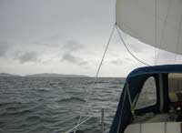 |
Cape Scott in the distance.
|
|
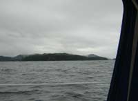
And up close (about a mile distant)
|
|
|
There was a pronounced swell from the south, left over from the previous night, of perhaps 3 metres (10 feet) over which the northwest wind was kicking up new waves, maybe a metre in height and running at an angle to the old swell. As a result, the surface was pretty lumpy and confused and wasn’t very easy on the stomach. We both felt queasy, particularly when we were sitting doing nothing while the other guy steered. Since we couldn't both steer all the time, and I’ve always had a weak stomach anyway, eventually I succumbed.
I wouldn't mind being seasick all that much, if I could be less enthusiastic. My stomach felt as if it was being wrung out. And tell me, once you've been sick, why do you have to do it again – and again? What part of empty doesn't seasickness understand? At least I felt better between times, but until we turned into Quatsino Sound and the motion changed, I was a pretty sorry sailor! Once into the sound however, I made an almost instant recovery, and was even looking forward to my dinner. Fraser, the lucky man, wasn’t nearly as affected.
We tied up at Winter Harbour 14 hours and 55 sea miles from Bull Harbour, having sailed at least 45 of those miles. We were the only boat to arrive that day. There was one other sailboat already there, and the owner came out to take our lines, which was nice of him. However, he spoiled the effect by popping back a moment later to ask Fraser if we were going to do anything about our halyard, which was still tapping against the mast – I mean, he could have waited until we had a chance to get settled. However, I thought Fraser’s reply was classic. He just gave the guy a big, cheerful grin and said “Oh no, we really like that sound, it sends us to sleep!”
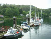 |
The docks in Winter Harbour, Forward Inlet.
(That’s a smaller inlet near the mouth of Quatsino Sound.)
Optima is the sailboat on the right, at the end of the floating dock.
|
|
After our exertions, we gave ourselves the next day off, staying at the dock all day. We occupied ourselves by tidying up and re-stowing all our gear, as well continuing our exploration of all the various lockers to see what food we had on board and where it was. There were storage spaces tucked away all over the boat, a lot of them being under the bunks and settees, and we found a treasure trove of canned goods and staples, not to mention tools and spares for maintenance. Chris had left us some notes, and we knew where to find any essentials we might need, but we’d been looking for some time for those darned canned peaches, without success.
We explored Winter Harbour on foot. The store was only open from 1:00 pm to 6:00 pm, so shopping wasn’t high on the list, although we did pick up a couple of nice shirts. The fuel dock is open, more or less on demand, from morning to evening, but we had plenty of diesel, and thought we would wait until Coal Harbour to fill up. The store also offers showers, but we didn’t find that out until later – a pity, they would have been welcome!
There’s no beach to speak of, but there’s a boardwalk that follows the shoreline, providing access to the houses for about half a mile, or perhaps a little more, around the bay. This makes an interesting walk, and near the end a trail through the woods leads to the gravel road from Port Hardy, which takes you back to the docks.
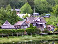
One of the houses along the boardwalk – several operate as bed and breakfasts.
|
|
|
 |
The start of the boardwalk
|
|
Two sailboats arrived in the afternoon, having motored all the way from Bull Harbour. They’d had about 20 knots of wind from the southeast, right in their faces, all the way from the cape. San Souci arrived two or three hours after them, having motor-sailed, taking a big tack out to sea. This made her journey longer, but the motion was much more pleasant with the sails to steady her, so the crew felt it was well worth the extra time.
There is a big sports fishing operation in Winter Harbour. They have a large hotel-type building on an old barge that’s grounded on the shore, and what we could see looked pretty nice. We couldn’t see a lot since the back of the building faced the public dock, but we could see the boats at their dock, and they were obviously very successful at catching fish.
Fraser, being a keen catcher and consumer of seafood, spent some time chatting with one of the commercial fishermen tied up to the public dock. He came back with some solid advice as to where we could catch some rockfish the next day.
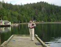
| The things you see when you haven’t got a gun! |
|
|
Wednesday we were underway about 9:00, as I recall. We were making our way down Forward Inlet, back to Quatsino Sound proper, when we saw an animal that wasn’t a seal or porpoise. A closer look showed that it was a sea otter – not a river otter swimming in the ocean, as we see around the gulf islands, but an honest-to-god sea otter! These big animals were hunted almost to extinction for their fur, but were reintroduced further down the west coast of the island in the seventies and have obviously done well. We watched this one floating on its back in the classic sea otter “poster” position, with its webbed back feet sticking up and its front paws holding something on its chest. I was taken completely by surprise, having always thought they lived offshore, not in the inlets. We saw a second one a little further on, neither seemed very concerned about us, but they wouldn’t let us get close either.
Leaving the otters, we slowly motored along a line calculated to bring us over our intended fishing spot. When the depth rose sharply, we were there, and Fraser dropped his lure (a buzz-bomb, I think) over the side. He let it down until he felt the bottom, raised it up and gave it a twitch, and bang, he had a fish. He did that twice more, and two more fish joined the first just as quickly. Two of the three were a greenish-yellow shade, and the third, a little bigger, was blue-grey. We put them aside for dinner, and carried on up the Sound.
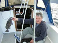 |
The happy fisherman. It took about as long to catch this fish as it took the lure to reach the bottom…
|
|
About half way up the sound, a mile or two short of Drake Island, we saw more sea otters, this time in three groups of a dozen or more each. Again, they were floating and feeding without a care in the world. I tried a few pictures, but the otters showed up as mere dots in the water. However, we had an excellent view through the binoculars, and spent some time watching them dive, then surface to eat whatever they had caught. All the references I’ve read or seen speak of sea urchins as the otters’ primary food source, and the sea urchins are supposed to hang out in kelp beds. However, there was no kelp visible, and we didn’t know what these otters were feeding on.
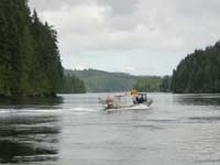
To reach Coal Harbour it’s necessary to pass through Quatsino Narrows. These are a few hundred yards wide by about two miles long, with currents flowing at up to nine knots. We arrived a couple of hours before slack water, but the tides were at a moderate part of their cycle, so we only had about two knots against us, and the diesel had no trouble pushing us through.
This is Quatsino Narrows. The tide sweeps through here like a river –Holberg Inlet, eighteen miles long, is just around the corner and this is the only way in or out for all that water.
Here it’s only running a couple of knots, but it can reach nine knots during spring tides.
|
|
|
We arrived in Coal Harbour around noon. I made a fairly sloppy downwind docking, but didn’t break anything. Next time I’ll go to the trouble of moving the fenders to the other side and come in facing into the wind, as I should have done this time. Coal Harbour was the last whaling station in BC, and there is still an arch made of the jaw bones of a blue whale, along with an old harpoon gun, on display. However, the town itself is in decline, and appears to be becoming no more than a suburb of Port Hardy, ten miles away.
The only obvious commercial enterprise was the seaplane base, which had a steady traffic. The base was built during the Second World War, I think, and was designed for flying boats, as it has a wide concrete ramp for the aircraft to leave and enter the water. The current aircraft there are Cessnas and Dehavilland Beavers. We watched a Beaver arrive and depart several times while we were tied up at the dock. Since the base doesn’t have a dock, the aircraft was transported to and from the water on a forklift, whose long forks reached from the front under the floats. Passengers entered the aircraft where it was parked by the hanger, then the loaded plane was picked up and carried to the water. The pilot stood on the float to push off from the forklift, then jumped into his seat and started the engine before the plane drifted onto the shore. Retrieval was the same procedure in reverse. A Beaver has no clutch, as soon as the motor starts the prop is turning and the plane is moving forward, so there’s a certain amount of skill and dexterity called for here!
Chris arrived in the mid-afternoon, having caught the bus to Port Hardy and hitch-hiked the rest. He brought some welcome fresh food, including wine for dinner (we’d been getting by on a few beers and the occasional hot rum – such hardship!)
The three of us cruised Quatsino Sound for another four days, visiting Port Alice to the south and also returning to Winter Harbour for fuel – the fuel dock at Coal Harbour had closed since our guidebook was updated. We caught and ate a few more rockfish, (very good) and caught one salmon but threw him back as too small. We were mistaken about that, as it turned out, we could have eaten it with clear consciences (sorry, Fraser!) We saw more sea otters and also enjoyed a couple of perfect anchorages, well protected from all winds and with excellent holding. We shared one of these with a big black bear, and were able to get quite close to him in the dinghy, as these animals don’t have very good eyesight. They have great noses, though, and when a wind shift took our scent to him, he was gone in a flash.
Here’s a few photos from this part of the cruise:
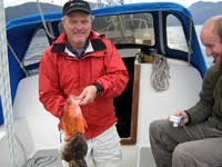 |
That’s one greedy fish there!
The little guy, with a buddy, made a nice snack. The big guy on the bottom lasted through a fry-up and a chowder, with enough left over to successfully bait the crab trap.
|
|
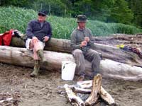
Chris tries charming the snakes, while Fraser is:
(a) standing guard, or
(b) hoping he’ll stop soon. |
|
|
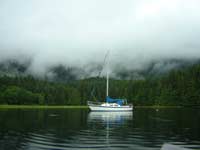 |
Tranquility base!
|
|
It seemed a very short time before we were back at Coal Harbour where Bob, crewman for the next leg of Optima’s circumnavigation, drove up to meet us, bringing my old van for our trip home.
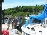
| Time to go. Here we are on the dock in Coal Harbour, taking Fraser’s and my gear off and loading Bob’s, along with supplies for the next leg of the trip, around the Brooks Peninsula to Kyuquot Sound. |
|
|
Thanks, Chris, and Fraser too. I thoroughly enjoyed our time on board.

Other articles by Jamie Orr:
|